


In lieu of mindlessly reposting (yet another) image of catastrophe, al-nakba al-mustamirra, feeding into this 16+ months-long hamster wheel of performative solidarity, the genocide-influencers’ clickbait metrics, and hollow calls for eyes on somewhere or another—an exercise, an attempt to engage with space…site…destruction.
Instructions, initially to my very small circle of followers on Instagram, and to us all:
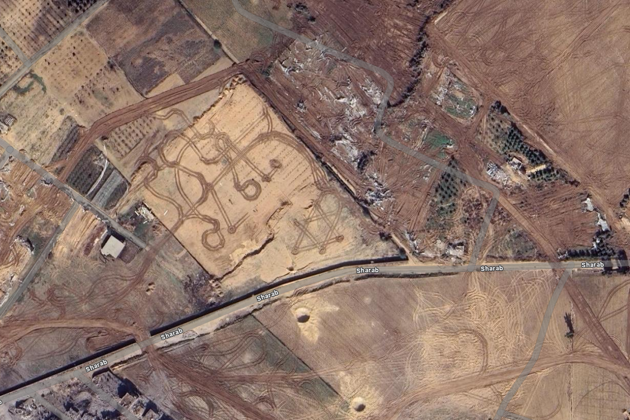
Google Maps >> “Beit Hanoun” >> follow Al Karameh northwest to Sharab
And then tell me what you see
Though this vignette circulated elsewhere earlier on January 25, 2025—alongside news of Toufan al-Ahrar (Flood of the Free) and breathtaking images of 200 liberated Palestinian prisoners embracing their beloveds, their land—the satellite view (31.543041, 34.545351) of a Star of David plowed into the soil by bulldozer, front loader, excavator; a seeping scab of Zionist settler colonialism, rendered open-access to the planet’s gaze.
Except, that it’s not that “open”. Because of course we know every map is an expression of power, control—and is never, ever objective nor neutral. These mounds, these breathing wounds on Palestine and its people are part of the longue durée of imperial plunder; material pasts desecrated by the enemy…presents, to be unearthed and rehabilitated…futures, to be rebuilt.
For example, during Operation Desert Storm, the US 1st Infantry Division (Mechanized) utilized minesweeping plows mounted on tanks along with “combat earthmovers” as “bulldozer assault.” From a 2020 report:
Rather than clear the trenches man by man, the Americans simply plowed through the Iraqis on combat earthmovers, even burying some defenders alive as they tried in vain to shoot the bulldozers.
“For all I know, we could have killed thousands,” Col. Anthony Moreno, commander of the brigade that led the assault, told The Seattle Times. “I came through right after the lead company. What you saw was a bunch of buried trenches with people’s arms and things sticking out of them.”
Professor Danika Cooper writes at length about “strategic invisibility” of desert spaces accommodating the pursuit of activities out of public view and beyond the realm of judicial and civic oversight,” globally, and as in Xinjiang Uyghur Autonomous Region (Xinjiang) in northwest China for The Belt and Road Initiative. She adds, “satellite imagery show[s] over time how the landscape is fundamentally transformed by the construction of [detention camp] architecture, transportation networks, and security infrastructure necessary to conceal the imprisonment of the Uyghur population.”
Seemingly innocuous browsing in Google Maps and correlated cartographies connect the in/visibility of geostrategic military positioning, internment, mass graves and bordering practices spanning continents, but ultimately primarily to line the pockets of Silicon Valley magnates and “defense” companies.
So do not stop scrolling over this heaved, pillaged land solely at Beit Hanoun.
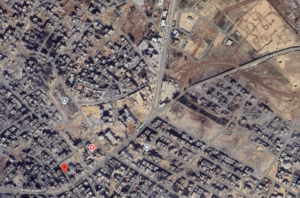
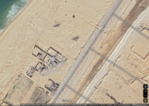
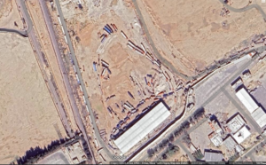
We can toggle east towards Salah Al Deen to how excavators and bulldozers claw across the Erez Checkpoint; loops, lines and cross-hatched tracks obliterating all in their way, on both “sides” of the so-called 1950 Armistice Line. Further west towards the Mediterranean Sea, nearly all’s been flattened along Al Rashid—beach front resorts, generational Palestinian homes, gardens, cafes and shops have been razed, now only resembling a monochrome sand. Many geolocations for hotels and restaurants are presently marked “temporarily closed.”
But this “temporary” is precisely why journalists like Al Jazeera’s Maram Humaid and many other civilians are shot by the IOF near the Netzarim Corridor. Why private security companies like Safe Reach Solutions and UG Solutions, along with Constellis (formerly Blackwater), Fogbow, and to-be-named Egyptian firms are contracted to control (“screen”) Palestinians returning to the north. This is why the colonizers are delaying…stymieing (as of January 26, 2025) thousands of Palestinians stuck in Khan Yunis or Al Mawasi yearning for home in Beit Lahia or Jabalia—in violation of the ceasefire agreement. The US-IOF-led annihilation of Gaza feeds from maintaining an impossibility of movement…of hindering coalescence and healing (burning, bombing hospitals, libraries, kindergartens!), ceaselessly terrorizing Palestinians and their land and constantly delaying—return. Naming, archiving, sharing both the tangible and ephemeral, circulating atrocity—demanding accountability—is a liberatory, active process, that sings of a borderlessness and futurity we know is within our lifetime. Liberation, is return.
–
As of January 24, 2025, the Committee to Protect Journalists report at least 159 Palestinian journalists and media workers were slain by the IOF since October 7, 2023, while dozens more are injured, reported missing and/or arrested. Voices in the December 2024 edition of The New York War Crimes write, “Without the Palestinians documenting the unrelenting horror of the past fourteen months, the Occupation’s narrative would go unchallenged.” They further, “Witnessing is not separate from dying for a cause, but part of the same continuum.” Palestinian journalists—concurrently surviving/documenting/testifying to this horror—our truth tellers—are sniped, maimed, disappeared precisely because they are providing us the highest-resolution possible.
In 1997, the National Defense Authorization Act enshrined the Kyl-Bingaman Amendment, a byproduct of Cold War era policy, into US law—affixing satellite resolution at 2 meters per pixel, solely for Israel’s “protection”. This law, as Zena Agha writes:
[Has] limited the quality and availability of high-resolution satellite imagery produced by U.S. companies covering Israel (and by implicit extension, the occupied Palestinian territories and the occupied Golan Heights). The result is that publicly available imagery on platforms such as Google Earth has been deliberately coarse and blurred.
On July 21, 2020, the National Oceanic and Atmospheric Administration (the regulatory body of the Act) dropped the resolution limit to 0.4m. This higher-fidelity satellite imagery is widely available to commercial companies and foreign governments. Said former head of Israeli space programs, retired Brig. Gen. Amnon Harai, “We would always prefer to be photographed at the lowest resolution possible…It’s always preferable to be seen blurred, rather than precisely.”
This blurring, while improved from decades past, is still very much an active tactic of this genocide—and the collusion in crime extends far beyond active-duty soldiers—including the corporations, nongovernmental organizations, think tanks and media who profit from Gaza’s destruction.
–
At the bottom of Google’s page, we note the copyright: Airbus, CNES/Airbus, Maxar Technologies, and Mapa GISrael. While my observations here cannot possibly contain the investigative labor of groups such as No Tech for Apartheid, Palestine Space Institute and Forensic Architecture who document, build databases, and effectively disseminate ties between the military industrial complex’s stakeholders/shareholders who facilitate the destruction of Palestine, it is vital to underscore how these companies are not just complicit in the United States and IOF’s genocidal rampages but at the fore. As example, “Maxar provides 90% of the commercial satellite imagery used to create foundational GEOINT for the U.S. government,” and is the prime contractor for the US Army’s “One World Terrain” program. (In December 2022, Maxar was acquired in a $6.4 billion cash deal by Advent International Corporation, an American global private equity firm). This is to say, these maps are currency, and what’s been redacted, strategically delayed, and opacified emboldens corruption, speculative trading, and the next border-in-progress.
There’s a yet-to-be-named cartography here; evidentiary of starvation, ecocide, -cide by every name…of aid trucks and ambush-vehicles-disguised-as-aid trucks, etched into our maps, ordering this world. What we must amplify[1], then, is the necessity of counter-mapping return, and constellations of care and freedom.
Footnotes
[1] Some resources, as starting point Palestine Open Maps, The Mapping Project, https://www.palquest.org/, Queering the Map, Palestine Land Society, The Atlas of Palestine.